Approximate Border Location
Wait Times
30–60 min typical
Just crossed? Tap to report:
Operating Hours
Open 7:00 AM–7:00 PM
Crossing Types
Pedestrians, vehicles
Border Type
Land crossing via road
Peak Times
7:00–10:00 AM, weekends
Daily Crossings
1,300–1,700 crossings
Safety Information
Safe, remote area
Languages Spoken
Malay, English
Accessibility Features
Ramps, assistance
About Kuala Lurah & Limbang (Sarawak)
Monthly Update (June 2026):
In 06/2026, the Kuala Lurah & Limbang Border Crossing is mostly stable, with regular movement between Brunei and Sarawak. Traffic tends to stay manageable, although inspections can take a little longer when several vehicles arrive together. Public holidays and weekend travel create the most noticeable fluctuations.
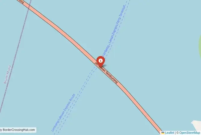
The Kuala Lurah-Limbang Crossing: The Temburong Transit
The border crossing at Kuala Lurah on the outskirts of Brunei’s capital, Bandar Seri Begawan, which connects to the Malaysian town of Limbang in Sarawak, is a unique and logistically crucial gateway. This is not a typical A-to-B border crossing. It is the first of two borders that you must cross if you are traveling overland from Brunei’s main territory to its exclave, the Temburong district. The journey requires you to exit Brunei, drive through the Malaysian territory of Limbang, and then re-enter Brunei on the other side. This crossing is therefore a vital transit route, a busy checkpoint for locals and travelers making this unique, multi-border journey. The atmosphere is that of a functional, busy commuter and transit border, a place where the complex and fragmented geography of Borneo becomes a practical, everyday reality. It is a border that you cross only to get to another border.
A History of a Divided Land
The history of this crossing is the history of the decline of the Bruneian Sultanate and the rise of the White Rajahs of Sarawak. In the 19th century, the Rajah of Sarawak, James Brooke, annexed the Limbang river basin from Brunei. This act, which the Sultanate has never formally recognized, split Brunei into two separate parts, creating the Temburong exclave. This historical event created the geographical anomaly that makes the Kuala Lurah-Limbang crossing a necessity for overland travel. For over a century, the only way to travel between the two parts of Brunei was by a long boat journey or by this complicated overland route through Malaysia. This has been a major logistical challenge and a source of national pride for Brunei to overcome. The Sultan Haji Omar Ali Saifuddien Bridge, opened in 2020, is a massive approximately 30-kilometer-long bridge that connects the two parts of Brunei directly by sea, dramatically reducing travel time to under 30 minutes and making the land route through Limbang less essential for most.
The Border Crossing Procedure: The First of Two Steps
The border is open typically from early morning until late evening (6:00 AM to midnight, with occasional extensions for holidays). The process is efficient, as officials are accustomed to the constant flow of transit traffic. You will need to have your passport ready for multiple stamps.Exiting Brunei (Kuala Lurah): You will arrive at the Bruneian immigration and customs complex. You will go to the passport control booth and get an exit stamp from Brunei. The process is quick and professional.Entering Malaysia (Tedungan, Limbang): After a very short no-man’s-land, you will arrive at the Malaysian immigration post of Tedungan. Here, you will get an entry stamp into Malaysia. For most nationalities, this is visa-free. It is important to ensure you get this stamp.The Drive Through Limbang: You are now officially in Malaysia. You will drive for about 45 minutes to an hour through the Malaysian town of Limbang and the surrounding countryside. This is the transit portion of the journey.Exiting Malaysia (Pandaruan): On the other side of Limbang, you will arrive at the Malaysian immigration post of Pandaruan. Here, you must get an exit stamp from Malaysia. This is a critical step.Entering Brunei Again (Puni): You will then cross a bridge over the Pandaruan River (the “Friendship Bridge”) to the Bruneian immigration post of Puni. Here, you will get a new entry stamp back into Brunei, this time into the Temburong exclave. You have now completed the four-stamp transit.
Signal can be a coin toss at borders, and the last thing you want is to be stuck at the gate hunting for info. We’ve pulled all our research for this region into one simple eBook that works 100% offline. It keeps everything you need in one spot so you can stay focused on the trip. Grab the guide here.
Route, Onward Travel, and the Temburong Exclave
This crossing is the start of the land route to Temburong. The main attraction in the Temburong exclave is the magnificent Ulu Temburong National Park, a pristine expanse of virgin rainforest. To visit the park, you typically need to join a tour from the capital, Bandar Seri Begawan. Historically, these tours would go by boat. With the opening of the new bridge, it is now possible to drive directly from the capital to Temburong without crossing into Malaysia at all. This has made the land transit route through Limbang less essential for tourists. However, it is still used by locals and by those who wish to visit the town of Limbang itself. Limbang is a classic, rough-around-the-edges Borneo river town and can be an interesting stop for the adventurous traveler. For those without a car, there are buses that ply the route from Bandar Seri Begawan to the town of Bangar in Temburong, which handle the border transit.
Final Planning Advice for a Unique Transit
The Kuala Lurah-Limbang crossing is a fascinating journey into the complex geography and history of Borneo. While the new bridge has provided a simpler alternative, the land transit route remains a unique travel experience. The key to a smooth journey is to be organized with your passport and to ensure you get all four necessary stamps (exit Brunei, enter Malaysia, exit Malaysia, enter Brunei). The officials are very familiar with this process. Be aware of the visa requirements for both countries. For most travelers today, the primary reason to visit Temburong is the national park, and the easiest way to do this is on a tour from the capital, which will now likely use the new bridge. The Limbang transit route is therefore more of an option for the dedicated overland explorer who wants to experience the unique geographical quirk of this divided land firsthand.
No reviews yet.