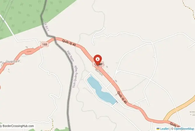
Approximate Border Location
Wait Times
30–60 min usual
Just crossed? Tap to report:
Operating Hours
Open 7:00 AM–5:00 PM
Crossing Types
Pedestrians, vehicles
Border Type
Land crossing via road
Peak Times
7:00–10:00 AM, weekends
Daily Crossings
1,200–1,800 crossings
Safety Information
Safe, remote area
Languages Spoken
Lao, Vietnamese, English
Accessibility Features
Ramps, assistance
About Bo Y & Ngọc Hồi (Phoukeua–Bờ Y)
Monthly Update (June 2026):
In recent weeks of 06/2026, Bo Y & Ngọc Hồi Border Crossing has stayed fairly calm and mostly stable. Passenger vehicles move through without much fuss, though truck checks sometimes stretch waits in the afternoon. Seasonal trade and rain showers are the biggest sources of variation.
The Bo Y-Ngọc Hồi Crossing: The Gateway to the Central Highlands
The border crossing at Bo Y in Attapeu Province, Laos, which connects to the Vietnamese post of Ngọc Hồi in Kon Tum Province, is the southernmost official land gateway between the two nations. This is a remote, mountainous, and beautiful crossing, a true off-the-beaten-path adventure for travelers exploring the deep south of Laos and the Central Highlands of Vietnam. This is not a major tourist route or a busy commercial highway. It is a quiet, sometimes sleepy checkpoint, serving local communities and a small but steady stream of adventurous travelers and motorcyclists. The journey to and from this border is a major part of the experience, taking you through rugged, undeveloped landscapes of forests, mountains, and ethnic minority villages. The atmosphere at the crossing is relaxed, the procedures are straightforward, and it feels like a passage into a wilder, less-explored part of Indochina.
A History on the Ho Chi Minh Trail
The history of this border is deeply entwined with the Ho Chi Minh Trail. The remote and rugged terrain of Attapeu Province in Laos and the Central Highlands of Vietnam made this region a critical corridor for the trail network during the Vietnam War. The area was the scene of intense secret bombing campaigns and special forces operations. The modern road that leads to the Bo Y-Ngọc Hồi crossing follows the path of some of these historic trails. After the war, the border was formalized as an international gateway to connect the southern provinces of the two allied socialist nations. It has remained a relatively minor crossing, however, due to the remoteness of the region and the challenging terrain. It is a border that has been shaped by the legacy of a secret war and the enduring wildness of the landscape. For the traveler, it is a journey through a region that still feels very much off the map, a place where the echoes of a hidden history can still be felt.
The Border Crossing Procedure: A Quiet Mountain Pass
The border is open from 07:00 to 17:00 daily. The process is generally smooth and hassle-free, with the main advantage being the almost complete lack of queues. You must have a valid visa for the country you are entering, obtained in advance. Visas on arrival are not available at this crossing.Exiting Laos (Bo Y): The Lao immigration and customs post is a simple, functional building located in a remote mountain setting. You will present your passport to the immigration officer, who will stamp you out of the country. The customs check is usually a very brief formality. The officials are typically relaxed and friendly.The No-Man’s-Land: After clearing the Lao post, you will proceed a short distance through a scenic, mountainous no-man’s-land to the Vietnamese side. The area is known for its beautiful pine forests.Entering Vietnam (Ngọc Hồi): The Vietnamese border post at Ngọc Hồi is a surprisingly large and modern facility that feels oversized for the current volume of traffic. You will enter the large hall and present your passport and your pre-arranged Vietnamese visa (or e-visa printout) to the immigration officer. They will process your entry and give you a stamp. After immigration, your luggage will be passed through an X-ray scanner for a customs check. The Vietnamese officials are professional and the process is generally efficient. Once you are cleared, you are officially in Vietnam.
Signal can be a coin toss at borders, and the last thing you want is to be stuck at the gate hunting for info. We’ve pulled all our research for this region into one simple eBook that works 100% offline. It keeps everything you need in one spot so you can stay focused on the trip. Grab the guide here.
Route, Onward Travel, and the Central Highlands
The journey to this border is a highlight. On the Lao side, the nearest major town is Attapeu. From there, it is a few hours’ drive on a paved but winding road to the border. On the Vietnamese side, from the Ngọc Hồi border, the nearest major town is Pleiku or Kon Tum. There are local buses and shared taxis waiting at the border to take you to these towns. This crossing is the perfect entry point for travelers wanting to explore the fascinating Central Highlands of Vietnam. This is a region of high plateaus, coffee plantations, and a rich diversity of ethnic minority groups (often referred to as Montagnards). The cities of Kon Tum, Pleiku, and Buon Ma Thuot are the main centers of the region. The Central Highlands have a very different feel from the rest of Vietnam and are a major destination for travelers interested in ethnic culture and the history of the Vietnam War. This crossing is also the logical entry point for those who have been exploring the 4000 Islands region of southern Laos and want to continue their journey into Vietnam.
Final Planning Advice for the Southern Route
The Bo Y-Ngọc Hồi crossing is a fantastic option for the adventurous traveler looking to explore the beautiful and culturally rich regions of southern Laos and the Central Highlands of Vietnam. The key to a successful crossing is to have your Vietnamese visa or e-visa sorted out well in advance. Do not arrive at this border expecting a visa on arrival. The transport connections are more localized, so you will need to be flexible and patient with the bus and shared taxi services. The crossing itself is one of the most relaxed and scenic you will find between the two countries. It is a gateway to a world of incredible mountain landscapes, rich history, and diverse ethnic cultures, a perfect starting point for an unforgettable adventure in the highlands of Indochina.
No reviews yet.