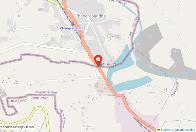
Approximate Border Location
Border Countries
- 🇧🇩Bangladesh
- 🇮🇳India
Border Cities
- 🇮🇳Burimari
- 🇧🇩Chanrabandha
Wait Times
30–60 min usual
Just crossed? Tap to report:
Operating Hours
Open 8:00 AM–6:00 PM
Crossing Types
Pedestrians, vehicles
Border Type
Land crossing via road/rail
Peak Times
7:00–10:00 AM, weekends
Daily Crossings
2,000–3,000 crossings
Safety Information
Safe, poor infrastructure
Languages Spoken
Bengali, Hindi, English
Accessibility Features
Ramps, assistance
About Burimari & Chanrabandha
Monthly Update (June 2026):
In recent weeks of 06/2026, Burimari & Chanrabandha Border Crossing has been fairly stable, though freight traffic often moves slower than private vehicles. Early mornings are usually quieter, while truck inspections can stretch waits later in the day. Seasonal trade demand and weather shifts still bring some variation.
The Changrabandha-Burimari Crossing: A Secondary Trade Route
The border crossing at Changrabandha in West Bengal, India, which connects to the land port of Burimari in the Lalmonirhat District of Bangladesh, is a secondary but important gateway between the two countries. It is located east of the main Banglabandha-Phulbari corridor and serves as an alternative route for trade and travel, particularly for traffic moving between Bangladesh and the Indian states of Assam and Meghalaya, as well as to Bhutan. This is primarily a commercial crossing, a busy land port dominated by the movement of goods like coal, stone, and agricultural products. While it is open to international travelers, it sees far fewer tourists than the more well-known crossings. For the traveler, it offers an off-the-beaten-path route, a chance to experience a functional, workaday border town, and a more direct path into the northern Rangpur division of Bangladesh.
A History of Railways and Reconnection
The history of this crossing is tied to the railway network built during the British Raj. The railway line that passed through Changrabandha and Burimari was part of the crucial network that connected the port of Kolkata with the tea gardens of Assam and the northern parts of Bengal. The 1947 Partition of India severed this line, and the crossing fell into disuse for many years. The road crossing was developed later to restore the local and regional trade links that had been disrupted. In recent years, as part of the push for greater sub-regional connectivity (under initiatives like the BBIN Motor Vehicles Agreement), the Changrabandha-Burimari crossing has been upgraded. It is seen as a key component in the network of trade corridors that aim to link Bangladesh, Bhutan, India, and Nepal. The focus has been on improving the infrastructure to handle a greater volume of freight, turning this once-forgotten railway point into a modern land port.
The Border Crossing Procedure: A Functional Land Port
The border is open during daylight hours. The process is formal and accustomed to commercial traffic, but less so to foreign tourists. You must have a valid visa for the country you are entering, obtained in advance.Exiting India (Changrabandha): The Indian immigration and customs offices are located in a designated area in the town of Changrabandha. The facilities are functional but may be more basic than the large Integrated Check Posts elsewhere. You will need to find the immigration office to get your passport stamped for exit. The customs officials will be busy with freight but will process your luggage.The No-Man’s-Land: After clearing the Indian side, you will proceed a short distance through a no-man’s-land to the Bangladeshi post. This can be done on foot or by rickshaw.Entering Bangladesh (Burimari): You will arrive at the Burimari Land Port. This is a large, formal facility. You will enter the immigration building, present your passport and your Bangladeshi visa, and get your entry stamp. The customs check is usually straightforward for tourists. The officials are professional, but as fewer tourists use this crossing, the process might take a bit longer as they may be less familiar with the procedures for non-commercial visitors. Once you are cleared, you are officially in Bangladesh.
Signal can be a coin toss at borders, and the last thing you want is to be stuck at the gate hunting for info. We’ve pulled all our research for this region into one simple eBook that works 100% offline. It keeps everything you need in one spot so you can stay focused on the trip. Grab the guide here.
Route, Onward Travel, and Regional Context
On the Indian side, the nearest major town is Cooch Behar, and the main transport hub of Siliguri is a few hours’ drive away. The road connects to the main highway network of West Bengal. On the Bangladeshi side, Burimari is a busy transport hub for the Lalmonirhat and Rangpur regions. There are regular bus services from the border to the major cities of northern Bangladesh, such as Rangpur, Dinajpur, and Bogra. This crossing is a convenient entry point for travelers wishing to explore the northernmost districts of Bangladesh. It is also on a direct route for trade heading towards the Indian state of Assam and the Bhutanese border crossing at Samdrup Jongkhar. This makes it a strategic, though less-traveled, part of the regional transport network. For the tourist, it offers a more direct entry into the Rangpur region than the more westerly Banglabandha crossing.
Final Planning Advice for a Commercial Gateway
The Changrabandha-Burimari crossing is a viable option for the experienced traveler looking for an alternative route into northern Bangladesh or a more direct path from Bhutan towards the heart of Bangladesh. The key is to have your visas sorted in advance and to be prepared for a border that is more focused on trade than tourism. The transport connections are good, but they are local and regional rather than long-distance express services. The reward for using this crossing is a more authentic experience of a subcontinental commercial border, a chance to see the real, workaday connections that bind these nations together. It is a journey into the functional heart of regional trade, away from the more polished tourist gateways.
No reviews yet.