Approximate Border Location
Border Countries
- 🇧🇩Bangladesh
- 🇮🇳India
Border Cities
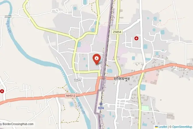
- 🇧🇩Hili
- 🇮🇳Hili (India side)
Wait Times
30–60 min typical
Just crossed? Tap to report:
Operating Hours
Open 8:00 AM–6:00 PM
Crossing Types
Pedestrians, vehicles
Border Type
Land crossing via road
Peak Times
7:00–10:00 AM, weekends
Daily Crossings
3,500–4,500 crossings
Safety Information
Safe, traffic buildup
Languages Spoken
Bengali, Hindi, English
Accessibility Features
Ramps, assistance
About Hili & Hili (India side)
Monthly Update (June 2026):
In 06/2026, the Hili Border Crossing remains active and mostly stable. Truck traffic tends to be slower than passenger movements, and lines often grow around midday. Seasonal rain and busy weekends can make crossing times less predictable.
The Hili-Hili Crossing: A Town Divided
The border crossing at Hili is one of the most unusual and intimate on the entire India-Bangladesh frontier. Here, the international border does not run between two towns, but right through the middle of a single, bustling market town. The western part of Hili lies in the Dakshin Dinajpur district of West Bengal, India, while the eastern part lies in the Dinajpur district of Bangladesh. A single road and a railway line pass through the town, with a simple fence and a gate marking the zero point. There is no wide no-man’s-land here. Houses and shops press right up against the border line. This is primarily a commercial crossing, a major land port for the trade of rice, wheat, and other agricultural products. For the traveler, it is a fascinating and slightly surreal experience, a place where you can witness the daily, complex reality of a community that was arbitrarily divided by the stroke of a pen during the 1947 Partition. The atmosphere is one of intense local commerce, where the international border is both a formidable barrier and a simple fact of everyday life.
A History of a Sundered Market
Before 1947, Hili was a single, thriving railway town and agricultural market. It was a key point on the main railway line connecting Kolkata with the tea gardens of Assam and the northern parts of Bengal. The Radcliffe Line, which demarcated the border between India and East Pakistan, was drawn directly through the town, bisecting the railway station, the market, and the community. The main part of the town went to East Pakistan (now Bangladesh), while a smaller section remained in India. This act of cartography created immense disruption. The main railway line was cut, and families found themselves living in different countries, sometimes just a few meters away from their relatives. The Hili crossing has, ever since, been a place of both formal trade and extensive smuggling. In recent years, both governments have invested in upgrading the facilities to create a more efficient land port to manage the significant volume of agricultural trade that flows through this unique, divided town.
The Border Crossing Procedure: A Compact and Busy Process
The border is open during daylight hours. The immigration and customs offices of both countries are located very close to each other, right in the heart of the bustling town. You must have a valid visa for the country you are entering, obtained in advance.Exiting India (Hili): The Indian immigration and customs offices are located in a designated building on the Indian side of the market. You will need to present your passport to get your exit stamp. The customs officials will check your luggage. The process is functional and takes place amidst the noise and activity of the surrounding town.The Crossing: The physical act of crossing is very short. You will walk a few meters past the Indian checkpoint, through a gate in the fence, to the Bangladeshi side. You are in the middle of a busy street, and the sense of simply stepping from one country into another is very immediate and striking.Entering Bangladesh (Hili): The Bangladeshi immigration and customs offices are located right at the border gate. You will enter the building, present your passport and your Bangladeshi visa, and get your entry stamp. The customs check is usually straightforward for tourists. Once you are cleared, you step out of the office and are immediately in the heart of the Bangladeshi part of Hili, with its own market, transport, and rhythm of life.
Signal can be a coin toss at borders, and the last thing you want is to be stuck at the gate hunting for info. We’ve pulled all our research for this region into one simple eBook that works 100% offline. It keeps everything you need in one spot so you can stay focused on the trip. Grab the guide here.
Route, Onward Travel, and Regional Context
On the Indian side, the nearest major railway station is at Balurghat, the district headquarters. From there, you can get connections to Kolkata. The road network connects Hili to other parts of West Bengal. On the Bangladeshi side, Hili is a busy transport hub for the region. There are regular bus services to the major cities of northwestern Bangladesh, such as Dinajpur, Bogra, and Rangpur. This crossing is a convenient entry point for travelers wishing to explore the northern regions of Bangladesh, including the UNESCO World Heritage site of Paharpur, the ancient city of Mahasthangarh, and the beautiful Kantaji Temple. The region is the agricultural heartland of Bangladesh, a landscape of vibrant green rice paddies and rural villages. The road network is extensive, making it relatively easy to travel around the region by bus.
Final Planning Advice for a Divided Town
The Hili crossing offers a unique and fascinating glimpse into the human consequences of the Partition of India. It is a less common route for foreign tourists, which can make it a more authentic and interesting experience. The key is to have your visas sorted in advance and to be prepared for a busy, somewhat chaotic market town environment. The proximity of the two immigration posts makes the process relatively quick, but the atmosphere is intense. This crossing is an excellent choice for the traveler looking to explore the rich archaeological and cultural heritage of northern Bangladesh. It is a border that is not just a line on a map, but a living, breathing entity, a place where two nations and a single community meet in a constant, complex, and colorful daily interaction.
No reviews yet.