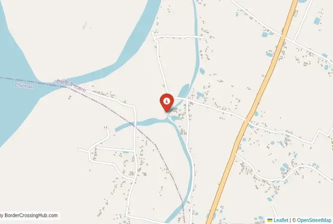
Approximate Border Location
Border Countries
- 🇧🇩Bangladesh
- 🇮🇳India
Border Cities
- 🇧🇩Agrabad Rowmari
- 🇮🇳Mankachar (India side)
Wait Times
30–60 min usual
Just crossed? Tap to report:
Operating Hours
Open 8:00 AM–6:00 PM
Crossing Types
Pedestrians, vehicles
Border Type
Land crossing via road
Peak Times
7:00–10:00 AM, weekends
Daily Crossings
2,500–3,500 crossings
Safety Information
Safe, river nearby
Languages Spoken
Bengali, Hindi, English
Accessibility Features
Ramps, assistance
About Agrabad Rowmari & Mankachar (India side)
Monthly Update (June 2026):
As of 06/2026, the Agrabad Rowmari & Mankachar Border Crossing stays mostly calm with light local traffic. Passenger vehicles and pedestrians usually move without long waits, though checks can take extra time during busier hours. Monsoon weather and local market days add some variation.
Important Note: A Local and Restricted River Crossing
The border crossing point between the Rowmari area in Bangladesh and Mankachar in the Indian state of Assam is a minor, riverine border. It is not an official, designated international crossing for foreign tourists. This is a local crossing, primarily used by residents of the immediate border area for small-scale trade and family visits, often by small boat across the Brahmaputra River and its tributaries. It lacks the formal immigration and customs infrastructure required to process international travelers. This guide is for geographical and contextual purposes only. It is not possible for a foreign tourist to use this crossing to travel between Bangladesh and India.
The Rowmari-Mankachar Crossing: A Riverine Frontier
This border crossing is located in one of the most dynamic and challenging landscapes on the subcontinent: the floodplain of the mighty Brahmaputra River. This is not a border defined by fences or pillars, but by the shifting channels of the river. The towns of Rowmari in Bangladesh and Mankachar in India are river towns, their lives and economies dictated by the annual floods and the fertile silt the river deposits. The border here is porous and difficult to police. For centuries, the people of this region, regardless of which side of the modern border they live on, have shared a common culture, language, and way of life, all centered on the river. The crossing is a reflection of this reality: a simple, informal point of transit for local people in a region where the river is a uniter, and the international border is a more recent, and sometimes abstract, division. The very nature of the crossing is fluid, often consisting of designated ferry points (ghats) on the riverbanks, where small wooden boats carry people and goods across the murky, powerful waters of the Brahmaputra. The scene is one of constant, localized motion, a world away from the static, bureaucratic nature of major land ports.
A History of a Fluid Border
The history of this region is the history of the Brahmaputra. The river has been a major artery for trade and migration for millennia, connecting the plains of Bengal with Assam and the eastern Himalayas. The political boundaries have shifted many times with the rise and fall of various kingdoms. The modern international border, created in 1947 by the Partition of India, cut through this fluid, riverine world, creating an international frontier in a place where none had truly existed before. However, the practicalities of life on the floodplain have meant that the border has always been difficult to enforce rigidly. The area is characterized by numerous “chars,” or river islands, which can change shape, size, or even disappear with the annual floods, further complicating the demarcation of the frontier. The Rowmari-Mankachar crossing point exists as a designated place for legal, local movement in an area where informal, undocumented crossings are common. It is a point of officialdom in a landscape that often defies fixed lines. The security forces of both India (BSF) and Bangladesh (BGB) maintain a strong presence in the region, constantly patrolling the river to control smuggling and illegal immigration, which are major challenges on this fluid frontier. This constant security presence adds a layer of tension to the otherwise mundane daily life of the river communities.
Signal can be a coin toss at borders, and the last thing you want is to be stuck at the gate hunting for info. We’ve pulled all our research for this region into one simple eBook that works 100% offline. It keeps everything you need in one spot so you can stay focused on the trip. Grab the guide here.
Border Procedures: Not Applicable for Tourists
As this is not an international crossing for foreigners, there are no procedures for tourists. The crossing is designated as a “Land Customs Station,” meaning its primary official purpose is to regulate and tax a limited amount of local, cross-border trade. It may also function as a point for local residents to cross under a “haat” (market) system or other bilateral agreements that allow for limited, permit-based movement. Any traveler attempting to cross here would be in violation of the immigration laws of both countries.For a foreign traveler, there is no way to get a legal entry or exit stamp at this location. The nearest designated international crossing for foreigners in this region would be much further south, at places like Dawki in Meghalaya (for a scenic, hilly crossing) or Petrapole-Benapole in West Bengal (for the main highway route). The Rowmari-Mankachar crossing is strictly for local use and is not part of the network of international gateways. Any foreigner arriving in this remote area would attract immediate attention from security and intelligence agencies on both sides, and would likely face detention and lengthy questioning. It cannot be stressed enough that this is not a viable or legal route for international travel.
The Regional Context: The Brahmaputra Floodplain
The crossing connects the Kurigram District of Bangladesh with the South Salmara-Mankachar District of Assam in India. This is one of the most remote, underdeveloped, and disaster-prone regions of either country. The annual monsoon floods regularly inundate vast areas, displacing hundreds of thousands of people and disrupting all forms of communication and transport. The economy is based on subsistence agriculture and fishing. The infrastructure is basic and often temporary, designed to be rebuilt after the floods. For an outsider, this is an extremely challenging environment to travel in. The security situation is also complex, with the porous border being a sensitive issue for both governments, who are concerned about the movement of insurgents, smugglers, and illegal immigrants. It is a region of immense natural power and profound human vulnerability, a world away from the tourist circuits of either India or Bangladesh. The challenges of daily life here are immense, and the presence of an international border adds another layer of complexity for the local population.
Final Contextual Note: A Border Defined by the River
The Rowmari-Mankachar crossing is a fascinating example of a border that is shaped and defined by a powerful natural force. It is not a static line on a map but a dynamic, fluid frontier on the banks of one of the world’s great rivers. It serves a vital purpose for the local communities who have lived with this river and this border for generations. However, for the international traveler, it is firmly off-limits. It is a place that highlights the vast difference between a local crossing and a designated international gateway. Any overland travel between Bangladesh and Northeast India must be done through the official, designated crossings like Dawki, where the proper facilities and legal framework are in place to welcome foreign visitors. This river crossing remains a testament to the resilience of local life in the face of both political geography and the overwhelming power of nature.
No reviews yet.