Approximate Border Location
Wait Times
15–30 min typical
Just crossed? Tap to report:
Operating Hours
Open 24 hours
Crossing Types
Pedestrians, vehicles
Border Type
Land crossing via road
Peak Times
7:00–10:00 AM, weekends
Daily Crossings
4,000–6,000 crossings
Safety Information
Generally safe, traffic queues
Languages Spoken
Hindi, Nepali, English
Accessibility Features
Ramps, elevators
About Banbasa & Dodhara Chandani
Monthly Update (June 2026):
As of 06/2026, the Banbasa & Dodhara Chandani Border Crossing is mostly stable and moves at an easy pace. Local traffic and pedestrians usually pass through without long waits, though afternoons can feel busier. Monsoon showers and holiday travel can slow things down for a while.
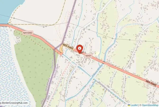
The Banbasa Crossing: A Gateway to Far-Western Nepal
The border crossing at Banbasa in the Champawat district of Uttarakhand, India, which connects to the Nepali municipalities of Dodhara and Chandani via the Mahakali River, is the primary gateway to the remote and beautiful far-western region of Nepal. This is not a bustling, chaotic crossing like Sonauli or Raxaul. It is a more relaxed, scenic border, defined by the presence of the mighty Mahakali (or Sharda) River and the long barrage that serves as the bridge. This crossing is popular with independent travelers, particularly those on motorcycles or in their own vehicles, who are looking to explore the less-trodden paths of Nepal, such as the Suklaphanta National Park. The atmosphere is relatively low-key, the procedures are straightforward, and the sense of entering a different, more tranquil world is immediate as you cross the river and head towards the Terai plains of Nepal.
A History Defined by a River
The Mahakali River has been the lifeblood of this region for centuries, but it has also been a source of political contention. The 1816 Sugauli Treaty between the British East India Company and the Kingdom of Nepal established the river as the western border between the two states. The Banbasa Barrage, a large dam and bridge structure, was built in the 20th century to control the river’s flow for irrigation and hydroelectric power. The sharing of the river’s resources has been the subject of complex treaties and occasional disputes between India and Nepal. The crossing itself has grown in importance as infrastructure in far-western Nepal has improved. It is a vital link for the residents of Nepal’s Sudurpashchim Province, providing access to Indian markets, healthcare, and transportation networks. For India, it is a key point for trade and for managing the open and porous border that characterizes the relationship between the two friendly nations.
The Border Crossing Procedure: A Two-Part River Crossing
The border is open during daylight hours only (typically 6:00 AM to 7:00 PM). The process is generally smooth and can often be completed in under an hour. The two immigration posts are located on either side of the long barrage over the river.Exiting India (Banbasa): The Indian immigration and customs office is located in the town of Banbasa, on the eastern side of the river. It is a small, straightforward office. You must present your passport to the immigration officer, who will stamp you out of India. If you are crossing with your own vehicle, you will need to have your carnet de passages (for a foreign-plated vehicle) or other vehicle documents processed by the customs officials here. The officials are generally friendly and efficient.The Barrage Crossing: After clearing Indian immigration, you will travel across the long Banbasa Barrage. This is the physical act of crossing the border. You can walk, cycle, or drive across. The views of the Mahakali River are impressive. The barrage itself is a controlled area, and photography may be restricted.Entering Nepal (Dodhara Chandani): The Nepali immigration office is located on the western side of the barrage. It is also a small and simple building. Here, you will need to obtain your Nepali visa. Visas on arrival are available for most nationalities. You will need to fill out a form, provide a passport-sized photograph, and pay the visa fee in a major international currency (US dollars are best). The process is quick. Once you have your visa, the officer will stamp your passport. If you are with a vehicle, you will need to pay a vehicle entry fee and get a temporary import permit (bhansar) from the customs office. This is a simple and inexpensive process for a short visit.
Signal can be a coin toss at borders, and the last thing you want is to be stuck at the gate hunting for info. We’ve pulled all our research for this region into one simple eBook that works 100% offline. It keeps everything you need in one spot so you can stay focused on the trip. Grab the guide here.
Route, Onward Travel, and Regional Attractions
The crossing is located near the Indian town of Banbasa, which is well-connected by road to other parts of Uttarakhand and Uttar Pradesh. On the Nepali side, you enter the Kanchanpur District. The nearest major town is Mahendranagar. From Mahendranagar, you can travel east along the main Mahendra Highway, which traverses the entire length of Nepal’s Terai plains. The primary attraction in this region is the Suklaphanta National Park, one of the last remaining habitats for the majestic swamp deer (barasingha) and a fantastic place for wildlife viewing, including tigers, rhinos, and elephants. The far-western region of Nepal is much less developed for tourism than the central and eastern parts of the country, offering a more authentic and adventurous experience. The roads are generally in good condition, and the landscape of the Terai is flat and agricultural.
Final Planning Advice for the Far-West Gateway
The Banbasa crossing is an excellent choice for the independent traveler looking to explore a quieter and more wild side of Nepal. The key to a smooth crossing is to arrive during daylight hours and to be prepared for the Nepali visa on arrival. Have a passport photo and clean US dollar bills in the correct denominations for your visa fee. For drivers, having your vehicle documents in order is essential. The crossing is a pleasant and scenic entry point, a perfect start to an adventure in Nepal’s beautiful and biodiverse far-west. It offers a welcome respite from the chaos of the more popular crossings and serves as a reminder of the peaceful and open nature of the Indo-Nepalese border.
No reviews yet.