Approximate Border Location
Wait Times
30–90 min usual
Just crossed? Tap to report:
Operating Hours
Open 8:00 AM–6:00 PM
Crossing Types
Pedestrians, vehicles
Border Type
Land crossing via road
Peak Times
7:00–10:00 AM, weekends
Daily Crossings
1,900–2,100 crossings
Safety Information
Restricted, security risks
Languages Spoken
Arabic, English
Accessibility Features
Ramps, assistance
About Hawf & Sarfait
Monthly Update (June 2026):
As of June 2026, the Hawf & Sarfait Border Crossing stays somewhat unpredictable, though many days remain quiet. Trucks usually take longer than passenger vehicles, and strong winds or poor visibility in the mountains can slow things down. Local travel patterns and weather are the biggest sources of variation.
Grave Security Warning: Do Not Approach
Travel to any part of Yemen is exceptionally dangerous and is strongly advised against by all major international governments. The country is experiencing a severe civil war and humanitarian disaster. The Hawf-Sarfait border is a remote, heavily militarized checkpoint in a mountainous region. It is not open for civilian or tourist traffic. This guide is for informational and geopolitical context only and must not be used for travel planning. Approaching this border is extremely hazardous.
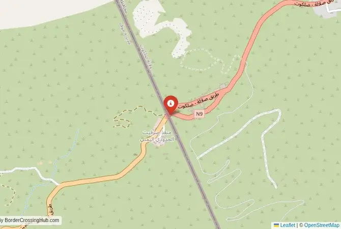
The Sarfait Crossing: A Strategic Mountain Outpost
The border crossing at Sarfait, connecting Yemen’s Hawf District with the Omani governorate of Dhofar, is a world away from the desert crossing at Al-Mazyunah. This is a high-altitude mountain pass, a winding road carved into the cliffs where the coastal mountains of Yemen and Oman meet the Arabian Sea. The crossing is small, strategic, and subject to intense security. Its primary role is not trade or tourism but military and security control of a rugged and historically rebellious frontier. The weather itself is unique, as the area catches the edge of the Khareef monsoon, shrouding the mountains in thick fog and drizzle for part of the year, a stark contrast to the arid landscapes typically associated with the region.
A History of Insurgency and Fortification
The history of this border is defined by the Dhofar Rebellion (1962-1976), a protracted insurgency that the Omani government, with significant British and Iranian support, fought to suppress. The rebels used the mountainous terrain and the porous border with what was then South Yemen as a sanctuary and supply route. The Sarfait area was the scene of some of the most intense fighting of the war. As a result, after the conflict, the Omani government heavily fortified this frontier, building a series of military posts, fences, and surveillance systems known as the “Hornbeam Line.” The Sarfait crossing is a modern manifestation of this security-first approach. With the onset of the Yemeni civil war, its role as a listening post and a barrier against potential infiltration has become even more critical. It is a border built by conflict and maintained by the perpetual need for vigilance.
Signal can be a coin toss at borders, and the last thing you want is to be stuck at the gate hunting for info. We’ve pulled all our research for this region into one simple eBook that works 100% offline. It keeps everything you need in one spot so you can stay focused on the trip. Grab the guide here.
Border Procedures: A Military Checkpoint
This crossing is not open to the public, commercial traffic, or any form of tourism. It is a military-controlled zone. Movement through Sarfait is restricted to pre-authorized military personnel and, in very rare and highly coordinated cases, diplomatic or high-level security convoys. There is no civilian infrastructure for processing visas, customs, or immigration for the general public. The procedures here are purely security-based, involving multiple checks of identification, authorization papers, and vehicle contents by the Omani military. Any unauthorized approach to the crossing would be met with an immediate and firm response from security forces. It is, for all practical purposes, a sealed military frontier rather than a public border crossing.
The Surrounding Region: The Hawf Forest and the Dhofar Mountains
The landscape around the Sarfait crossing is unique and ecologically significant. On the Yemeni side lies the Hawf Forest, a protected area that is an extension of the monsoon-affected ecosystem of Dhofar. It is one of the few forested areas on the Arabian Peninsula. On the Omani side, the road winds down from the high mountains towards the coastal city of Salalah. The entire region is characterized by steep escarpments, deep wadis, and, during the Khareef season (June to September), lush green vegetation and dense fog. The Omani side is well-developed for tourism, with roads leading to scenic viewpoints like the one at Jebel Samhan. However, the immediate border area remains a restricted military zone. The stark contrast between the accessible tourist areas of Dhofar and the sealed-off border at Sarfait highlights the immense security challenges Oman faces in preserving its stability while neighboring a country in deep crisis.
Final Contextual Note: A Sealed Frontier
The Sarfait border crossing is a clear illustration of a hard, militarized frontier. Its purpose is not to facilitate movement but to prevent it. It stands as a symbol of Oman’s successful efforts to insulate itself from the chronic instability that has plagued its neighbors for decades, first during the Dhofar Rebellion and now during the Yemeni civil war. Its dramatic mountain location and unique climate make it a point of geographical interest, but it is one that must be appreciated from a great distance. The crossing is a functioning military outpost, a sealed gate on the edge of a conflict zone, and it is absolutely off-limits to all unauthorized individuals.
No reviews yet.