Approximate Border Location
Border Countries
Border Cities
- 🇺🇿Khodjeily (Khodjeily)
- 🇹🇲Kunya‑Urgench
Wait Times
15-60 min typical
Just crossed? Tap to report:
Operating Hours
6:00 AM – 10:00 PM
Crossing Types
Pedestrians, vehicles
Border Type
Land crossing via road
Peak Times
7:00-10:00 AM
Daily Crossings
1200-1800 daily
Safety Information
Quiet crossing; low incidents
Languages Spoken
Turkmen/Uzbek
Accessibility Features
Ramps, assisted access
About Khodjeily (Khodjeily) & Kunya‑Urgench
Monthly Update (May 2026):
The Khodjeily & Kunya‑Urgench Border Crossing is ticking along at a relaxed pace this May 2026. It’s mostly stable, though the Turkmen side usually slows down for anyone needing a visa on arrival. The only real source of variability is when a couple of tour buses show up at once, which can make the small lobby feel a bit crowded.
A Crossing to an Autonomous Republic
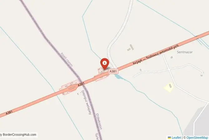
Important Note for Travelers: Turkmenistan is one of the most closed and tightly controlled countries in the world. This is a remote border crossing. It is absolutely essential to have all visas and permits in perfect order and to verify the crossing’s operational status before attempting to cross. The border crossing connecting the area near the historic site of Konye-Urgench in Turkmenistan with the region of Khodjeily in Uzbekistan is a journey into one of the most remote and historically fascinating parts of Central Asia. This is a secondary checkpoint that serves as the main gateway between Turkmenistan and the autonomous Republic of Karakalpakstan in Uzbekistan. To cross here is to travel a route that links the ruins of one of the greatest cities of the Islamic world with the desolate landscape of the Aral Sea disaster. It is a passage through a land of immense history, ecological tragedy, and a unique and resilient culture.
Operational Details
This checkpoint connects Turkmenistan’s Daşoguz Province with the Republic of Karakalpakstan in Uzbekistan. It is an international crossing, but it is very remote, and it is crucial to check its operational status and hours before travel, as it may not be open 24/7. The crossing is intended for passenger cars and local traffic. The road leading to the border on both sides can be in poor condition. The traffic is generally very light, but the procedures, especially on the Turkmen side, can be extremely slow and bureaucratic.
A History of the Khorezmian Empire and the Aral Sea
The history of this region is the history of the Khorezmian Empire and the Amu Darya river delta. The ancient capital, Gurganj (now Konye-Urgench), was a major center of science and culture before its destruction by the Mongols. The region of Karakalpakstan was a land of nomadic peoples, a remote oasis on the shores of the Aral Sea. The modern border is a legacy of the Soviet administrative divisions. The great tragedy of this region in the 20th century was the drying up of the Aral Sea, a man-made ecological disaster caused by the diversion of the Amu Darya and Syr Darya rivers for cotton irrigation. This crossing is a gateway to the epicenter of that disaster.
Signal can be a coin toss at borders, and the last thing you want is to be stuck at the gate hunting for info. We’ve pulled all our research for this region into one simple eBook that works 100% offline. It keeps everything you need in one spot so you can stay focused on the trip. Grab the guide here.
The Border Crossing Procedure
The border crossing procedure is a complex, multi-stage, and often extremely slow process, particularly on the Turkmen side. You will need a valid passport and valid visas for both countries, which must be obtained well in advance. A Letter of Invitation (LOI) is typically required for a Turkmen visa. Upon entering Turkmenistan, you will be required to pay numerous taxes and fees. The customs inspection is extremely thorough, with detailed searches of luggage and electronic devices. Be prepared for a long, bureaucratic, and often frustrating experience that can take half a day or more.
The Surrounding Region: Turkmenistan Side
On the Turkmen side, the crossing is near the magnificent ruins of ancient Konye-Urgench, a UNESCO World Heritage site. The site features some of the most impressive monuments in Central Asia, including the towering Kutlug-Timur Minaret and the beautiful Turabek-Khanym Mausoleum. It is one of the most important historical sites in Turkmenistan. The nearby city of Dashoguz is the main regional center.
The Surrounding Region: Uzbekistan Side
On the Uzbek side, the crossing is in the Republic of Karakalpakstan. The nearby town of Khodjeily has an important necropolis. The main destination is the regional capital, Nukus. Nukus is famous for housing the Savitsky Museum, also known as the “Louvre of the Steppes,” which contains a world-class collection of Russian avant-garde art that was hidden from the Soviet authorities by its visionary founder, Igor Savitsky. Nukus is also the main base for “disaster tourism” trips to the “ship graveyard” at Moynaq, a former fishing port that is now stranded in the middle of the desert that was once the Aral Sea.
Practical Travel Information
Practical planning is absolutely essential for this route. You must have all your documents in perfect order. The official currencies are the Turkmen Manat (TMT) in Turkmenistan and the Uzbekistani Som (UZS) in Uzbekistan. The roads can be in very poor condition. Services are extremely limited. You must be completely self-sufficient with fuel, food, and water. Ensure you have a clear plan for your onward transport from the border, as it is located in a very remote area.
Final Considerations
The Konye-Urgench–Khodjeily border crossing is a journey for the most adventurous and well-prepared of travelers. It is a passage through a landscape of immense historical grandeur and profound ecological tragedy. It is a gateway to the magnificent ruins of a lost empire and to the haunting spectacle of a lost sea. It is a border that is a testament to the enduring legacy of the ancient Silk Road and a powerful symbol of the unique and enigmatic character of modern Turkmenistan and the resilient culture of Karakalpakstan.
No reviews yet.