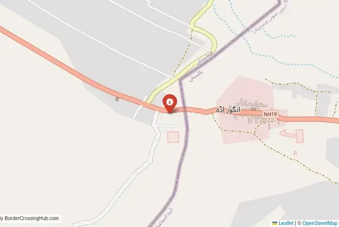
Approximate Border Location
Border Countries
- 🇦🇫Afghanistan
- 🇵🇰Pakistan
Border Cities
- 🇦🇫Angur Ada
- 🇵🇰Paktika region
Wait Times
15-60 min typical
Just crossed? Tap to report:
Operating Hours
6:00 AM – 10:00 PM
Crossing Types
Pedestrians, vehicles
Border Type
Land crossing via road
Peak Times
7:00-10:00 AM
Daily Crossings
800-1200 daily
Safety Information
Sensitive area; strict controls
Languages Spoken
Dari/Urdu
Accessibility Features
Ramps, assisted access
About Angur Ada & Paktika region
Monthly Update (June 2026):
As of 06/2026, Angur Ada & Paktika Border Crossing ticks along in a mostly stable way, though busy days still bring uneven waits. Freight trucks tend to slow things down more than smaller vehicles, especially in the morning. Local events and changing border procedures can make crossing times less predictable.
A Crossing in the Heart of Waziristan
Important Note for Travelers: This border crossing is located in an extremely volatile and dangerous region that has been a major conflict zone for decades. The security situation is unpredictable. Travel to this region is extremely dangerous and strictly forbidden for foreigners without official permission and heavy security. This guide is provided for historical and informational purposes only. The border crossing at Angur Ada, connecting the South Waziristan district of Pakistan with the Barmal District of Afghanistan’s Paktika Province, is a journey into one of the most remote and notorious frontier regions on earth. This is not a major trade corridor; it is a secondary checkpoint that has been a major infiltration route and a flashpoint for conflict. To cross here is to travel a route that has been a frontline in the “War on Terror,” a passage through a landscape of rugged mountains, fiercely independent Pashtun tribes, and a long and violent history of conflict. It is a crossing defined by its immense strategic importance and the constant presence of conflict.
Operational Details
This checkpoint connects Pakistan’s Khyber Pakhtunkhwa province with Afghanistan’s Paktika Province. It is one of the officially recognized crossings between the two nations, but its operation is often sporadic and subject to the prevailing security situation. The crossing has been the subject of disputes and even armed clashes between Afghan and Pakistani forces over the construction of border facilities. It is a key point for the local tribes, but it is not a major hub for international trade. Its importance is primarily strategic and military.
A History of the “Graveyard of Empires”
The history of this region is the history of Waziristan, a fiercely independent tribal area that has resisted outside control for centuries, earning the wider region the nickname “Graveyard of Empires.” The border, the Durand Line, was drawn by the British in the 19th century, cutting through the heart of the Wazir and Mahsud tribes’ territory. After the 9/11 attacks, South Waziristan became a major sanctuary for al-Qaeda and the Taliban. The region has been the scene of a long and bloody war between the Pakistani military and various militant groups, as well as a major theater for US drone strikes. The Angur Ada crossing has been a key strategic point throughout this conflict.
Signal can be a coin toss at borders, and the last thing you want is to be stuck at the gate hunting for info. We’ve pulled all our research for this region into one simple eBook that works 100% offline. It keeps everything you need in one spot so you can stay focused on the trip. Grab the guide here.
The Border Crossing Procedure
The border crossing procedure is an extremely rigorous and meticulous process, reflecting the extreme security situation. You will need a valid passport and valid visas for both countries, which must be obtained well in advance. The checks by both Afghan and Pakistani authorities are intense. The area is a major transit point for militants and smugglers, and the security forces on both sides are on high alert. For foreigners, crossing here would be an exceptional event, requiring high-level official permission and a major security detail. It is not a standard procedure.
The Surrounding Region: Pakistan Side
On the Pakistani side, the crossing is in the South Waziristan district. The main town is Wana. The region is a landscape of rugged, barren mountains and narrow valleys. It has been heavily affected by years of war, with many towns and villages destroyed and rebuilt. The area is still subject to military control, and access is heavily restricted. The journey from the main city of Dera Ismail Khan to the border is a journey through numerous military checkpoints.
The Surrounding Region: Afghanistan Side
On the Afghan side, the crossing is in the Barmal District of Paktika Province. This is a remote and mountainous region that has been a major stronghold for the Taliban and other insurgent groups for decades. The security situation is extremely volatile. The road from the border leads towards the provincial capital, Sharana. The region is known for its harsh terrain and its fiercely independent tribal population.
Practical Travel Information
Travel on this route is not possible for independent tourists. The entire region is a high-risk security zone. The official currencies are the Pakistani Rupee (PKR) in Pakistan and the Afghan Afghani (AFN) in Afghanistan. Any travel would have to be part of an official, heavily guarded convoy. The risks of kidnapping, IEDs, and terrorist attacks are extremely high.
Final Considerations
The Angur Ada border crossing is a journey into the heart of one of the world’s most famous and dangerous conflict zones. It is a place where modern geopolitics, tribal traditions, and religious extremism have converged to create a landscape of perpetual conflict. It is a strategic flashpoint that operates under the constant shadow of war. It is a border that is not for the traveler, but for the soldier, the spy, the tribesman, and the people who call this beautiful but unforgiving land their home. It is a true frontier, a line that is written in blood.
No reviews yet.