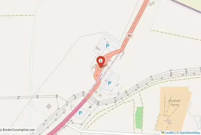
Approximate Border Location
Wait Times
30-120 min for pedestrians/vehicles
Operating Hours
Open 24 hours
Crossing Types
Pedestrians, vehicles, commercial
Border Type
Land crossing via road
Peak Times
Mornings (7-10 AM), weekends
Daily Crossings
~5000 travelers/vehicles
Currency Exchange
Available near Um Qasr (IQD, KWD)
Safety Information
Busy, security concerns
Languages Spoken
Arabic/Arabic
Accessibility Features
Ramps, elevators
About Abdali & Um Qasr/Safwan
A Crossing in a Historic War Zone
Important Note for Travelers: This border crossing is located in a region with a highly volatile and dangerous security situation. The border area has been a major conflict zone in multiple wars. Travel to this region is extremely dangerous and strongly discouraged. This guide is provided for historical and informational purposes only.
The border crossing connecting the area near Safwan in Iraq with Abdali in Kuwait is the only official land border between the two nations. This is not just a border; it is one of the most heavily fortified and politically sensitive frontiers in the world. To cross here is to travel through a landscape that has been the scene of two major wars, a passage through a flat, featureless desert that is defined by its immense strategic importance and the deep and painful history of the Iraqi invasion of Kuwait. It is a crossing that is less a gateway for tourists and more a critical security and logistical corridor.
Operational Details
This checkpoint connects the Basra Governorate of Iraq with the Jahra Governorate of Kuwait. It is a major international crossing, open 24/7, but its traffic is overwhelmingly commercial and official. The facility is massive and highly secured on both sides, with extensive fortifications, including a large berm and trench system built after the 1991 Gulf War. The crossing is the primary route for all trade between the two countries and is a vital lifeline for goods entering Iraq via Kuwaiti ports.
Before Crossing
Crossing borders gets messy sometimes, think political flare-ups or gates shutting fast. Good travel insurance is a must for handling doctor visits, trip disruptions, or security scares. Don’t get caught unprepared. To find a policy that’s got your back, check out reliable plans today for peace of mind.
A History of Invasion and Liberation
The history of this crossing is the history of modern conflict in the Middle East. The border was demarcated by the British in the early 20th century, but Iraq long refused to recognize it, maintaining a historical claim over Kuwait. In 1990, Saddam Hussein’s army invaded Kuwait, pouring across this very border. The subsequent 1991 Gulf War saw a massive coalition army, staging from Saudi Arabia, liberate Kuwait and push the Iraqi army back across this frontier. The famous “Highway of Death,” where retreating Iraqi forces were destroyed, is in this region. The town of Safwan was the site where the ceasefire agreement was signed. The border was then heavily fortified by the UN and Kuwait. In the 2003 US-led invasion of Iraq, this crossing was a primary point of entry for coalition forces.
The Border Crossing Procedure
The border crossing procedure is an extremely rigorous and meticulous process. You will pass through massive, modern, and highly secure facilities on both sides. You will need a valid passport and visas for both countries, which must be obtained well in advance. The security checks are intense, involving detailed inspections of vehicles and luggage. The process is designed for maximum security. For commercial truck drivers, the process is even more complex, involving detailed customs declarations and cargo inspections, and can take a very long time.
The Surrounding Region: Iraq Side
On the Iraqi side, the crossing is near the towns of Safwan and the major port city of Umm Qasr. The area is part of the Basra Governorate, the heart of Iraq’s oil industry. The city of Basra, with its rich history as the city of Sinbad the Sailor, is the main regional center. The region has been the scene of intense conflict for decades, from the Iran-Iraq War to the post-2003 insurgency, and the security situation remains volatile.
The Surrounding Region: Kuwait Side
On the Kuwaiti side, the crossing is in the northern part of the country. The nearby town of Abdali is an agricultural area. The road from the border is a modern motorway that leads directly to the capital, Kuwait City. The region is known for the vast oil fields that are the source of Kuwait’s immense wealth. The country has numerous memorials and museums dedicated to the 1990 invasion and the 1991 liberation, which are a central part of the modern national identity.
Practical Travel Information
Travel on this route is not possible for independent tourists. It is a highly controlled and restricted border. The official currencies are the Iraqi Dinar (IQD) in Iraq and the Kuwaiti Dinar (KWD) in Kuwait. The climate is one of extreme heat in the summer. The desert landscape is vast and empty. Any travel would have to be part of an officially sanctioned convoy or delegation and would involve extreme security precautions.
Final Considerations
The Safwan–Abdali border crossing is a powerful symbol of the turbulent history of the Persian Gulf. It is a place where the lines of modern conflict have been drawn and redrawn. It is a highly secured and functional checkpoint that serves as a vital economic link, but it operates under the constant shadow of its own violent past. It is a border that is defined not by the flow of tourists, but by the movement of oil tankers and the memory of real tanks. It is a true desert frontier, a line in the sand of immense strategic importance.
No reviews yet.
