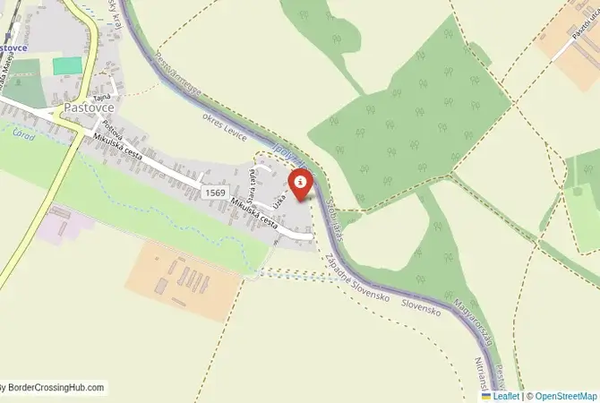
Approximate Border Location
Wait Times
No regular traffic
Just crossed? Tap to report:
Operating Hours
Closed
Crossing Types
Border Type
Land crossing via road (planned)
Peak Times
Daily Crossings
0 crossings
Safety Information
Site under development
Languages Spoken
Slovak/Hungarian
Accessibility Features
No facilities available
About Pastovce & Vámosmikola (planned)
Monthly Update (May 2026):
In these first weeks of May 2026, the Pastovce & Vámosmikola Border Crossing has stayed quiet and very understated. It mostly serves local traffic and agricultural vehicles, so you’ll rarely find any kind of line at the booths. It’s a predictable route, but a heavy spring storm or a change in the local harvest schedule can bring enough tractors to the road to cause a brief backup.
A Future Bridge in a Historic Valley
The planned border crossing connecting the Slovak village of Pastovce with Vámosmikola in Hungary represents a future hope for the communities of the lower Ipoly (Ipeľ) River valley. This is not yet a crossing you can make; it is a long-awaited project to build a new bridge that will restore a direct connection lost for nearly 80 years. Once built, it will be a seamless Schengen passage, but for now, its story is one of a severed connection, the challenges of cross-border planning, and the persistent desire of local communities to be reunited. The future bridge will be a journey through a landscape of fields, forests, and the winding Ipoly River, a symbol of a final healing of a World War II wound.
Future Operational Details
This planned checkpoint will connect Slovakia’s Nitra Region with Hungary’s Pest County. It will be a regional road bridge, designed for passenger cars, cyclists, and pedestrians, with a weight limit to exclude the heaviest freight traffic. The goal of the project is to improve local and regional connectivity, boost the local economy and tourism, and reduce travel times for residents who currently have to make long detours. The bridge will be a key part of the “Ipoly Bridges” program, a joint Slovak-Hungarian initiative, co-funded by the EU, to rebuild the many bridges on the river that were destroyed in the war.
A History of a Severed Connection
The history of this crossing is a story of a long-severed connection. The original bridge here was destroyed by retreating German forces in 1944. For the entire duration of the Cold War, and for three decades after, there was no bridge. The Ipoly River, which forms the border, was a hard, guarded frontier. The fall of the Iron Curtain and the accession of both countries to the EU created the opportunity to restore the link. However, the process of planning, funding, and getting international agreement for a new bridge is a long and complex one. The project has been discussed for many years, and while it remains in the planning stage with no construction started as of early 2026, the communities are still waiting for construction to begin.
Signal can be a coin toss at borders, and the last thing you want is to be stuck at the gate hunting for info. We’ve pulled all our research for this region into one simple eBook that works 100% offline. It keeps everything you need in one spot so you can stay focused on the trip. Grab the guide here.
The Future Seamless Border Procedure
Once the bridge is built and the crossing is open, there will be no border procedure for travelers. As both countries are in the Schengen Area, you will simply drive, cycle, or walk across the new bridge. There will be no passport checks and no customs inspections. This future reality is the main driver for the project. However, until then, the only way to cross is to travel to the nearest open bridge, which can add significant time and distance to a journey between these neighboring villages.
The Surrounding Region: Slovakia Side
On the Slovak side, the crossing is in a fertile agricultural region. The village of Pastovce is a quiet, rural settlement. The area is part of the Podunajsko region, the heartland of the Hungarian minority in Slovakia. The nearby town of Šahy is a major regional center on the Ipoly River. The region is known for its wine production and its beautiful, rolling landscape. The area is popular for cycling, with trails that will one day incorporate this new bridge.
The Surrounding Region: Hungary Side
On the Hungarian side, the crossing is in the Börzsöny mountains, a wild and beautiful range of hills that is a national park and a paradise for hikers. The village of Vámosmikola is a gateway to this region. The area is part of the beautiful Danube Bend, a scenic and historic region where the river turns south towards Budapest. The historic cities of Esztergom and Visegrád are a drive away. The region is known for its small, traditional villages and its pristine natural environment.
Practical Travel Information
Practical planning for this route is currently a matter of waiting. Travelers wishing to move between these two villages must use other nearby crossings, such as the one at Šahy-Parassapuszta. Once the bridge is open, practical planning will be very simple. The most important thing will be to have the required motorway vignettes if the journey involves motorways in either country. The official currencies are the Euro (EUR) in Slovakia and the Hungarian Forint (HUF) in Hungary. The new bridge will dramatically improve the accessibility of services for the local communities.
Final Considerations
The planned Pastovce–Vámosmikola border crossing is a story of hope and persistence. It represents the final stage of the effort to rebuild the connections that were destroyed in the 20th century. While it does not exist yet, its future opening will be a major celebration for the local communities and a powerful symbol of an integrated and cooperative Central Europe. It is a testament to the idea that even after 80 years, it is never too late to rebuild a bridge of friendship.
No reviews yet.