Approximate Border Location
Wait Times
20–60 min peak hours
Just crossed? Tap to report:
Operating Hours
24h open
Crossing Types
Pedestrians, vehicles, freight
Border Type
Land crossing via road
Peak Times
07–10 AM, weekends
Daily Crossings
10,000–14,000 crossings
Safety Information
Busy hub, routine policing
Languages Spoken
Slovak/Hungarian
Accessibility Features
Ramps, elevators available
About Rajka & Čunovo
Monthly Update (May 2026):
Moving through May 2026, the Čunovo & Rajka Border Crossing is looking mostly stable, though car lines often stack up on the Slovakian side during the morning rush. Most of the heavy lifting happens in the freight lanes, which stay quite busy while passenger cars usually tick along nicely. It’s a reliable run, but a holiday weekend or a sudden shift in local customs checks can stretch out the waits.
A Crossing in a Tripoint Region
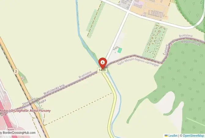
The border crossing connecting the Hungarian village of Rajka with the Bratislava suburb of Čunovo in Slovakia is a journey through a unique and strategically important location: the tripoint where Slovakia, Hungary, and Austria meet. This is the main motorway checkpoint on the M15/D2 highway, a critical corridor that links Bratislava with Budapest and the rest of the Balkans. Since both Slovakia and Hungary are members of the European Union and the Schengen Area, there are no permanent border controls. To cross here is to travel through a landscape that was once a heavily fortified corner of the Iron Curtain but is now a seamless hub of European transit, a place where three countries meet without barriers.
Operational Details
This checkpoint connects Hungary’s Győr-Moson-Sopron County with Slovakia’s Bratislava Region. It is a massive, multi-lane motorway crossing. While the permanent control booths are no longer in use, the facility is often used for temporary checks, particularly related to migration or security alerts. The crossing is open 24/7, and traffic flows freely at the posted speed limit. The only indication that you are crossing a border is a simple blue sign with the European Union stars. The Austrian border is just a few kilometers away, making this a true European crossroads.
A History of the Iron Curtain and the Gabčíkovo Dam
The history of this crossing is the history of the Cold War. For over 40 years, this was one of the most heavily fortified points on the Iron Curtain. The area was lined with barbed wire and watchtowers. The fall of the Iron Curtain in 1989 was a momentous event. The history of the region is also dominated by the Gabčíkovo-Nagymaros Dams project, a massive and controversial hydroelectric project on the Danube that led to a major international dispute between Hungary and Czechoslovakia (and later Slovakia). The reservoir and the new Danube channel have fundamentally altered the landscape of this area. The accession of both countries to the Schengen Area in 2007 completed the process of opening this once-impenetrable border.
Signal can be a coin toss at borders, and the last thing you want is to be stuck at the gate hunting for info. We’ve pulled all our research for this region into one simple eBook that works 100% offline. It keeps everything you need in one spot so you can stay focused on the trip. Grab the guide here.
The Seamless Border Procedure
Today, there is no border procedure for the vast majority of travelers. You simply drive along the motorway. There are no passport checks and no customs inspections. This is the reality of the Schengen Area. However, due to its strategic location at the tripoint, this crossing is frequently chosen by the authorities of all three countries for joint or individual random checks. You are still required to carry a valid passport or national ID card with you at all times. The open border has led to a unique phenomenon: the Hungarian village of Rajka has become a “suburb” of Bratislava, with thousands of Slovaks moving there for cheaper housing while commuting to work in the Slovak capital.
The Surrounding Region: Slovakia Side
On the Slovak side, the crossing is on the outskirts of the capital city, Bratislava. The suburb of Čunovo is home to the Danubiana Meulensteen Art Museum, a world-class modern art gallery situated on a peninsula in the Danube. It is also the site of the Čunovo Water Sports Centre, a world-class artificial whitewater canoe slalom course built in the new Danube channel. The Slovak capital, Bratislava, with its beautifully restored old town and castle, is just a short drive away.
The Surrounding Region: Hungary Side
On the Hungarian side, the crossing is in the Szigetköz region, a beautiful “inland delta” of the Danube with a maze of river branches, islands, and floodplain forests. It is a paradise for canoeing, fishing, and cycling. The nearby city of Győr has a beautiful baroque city center. The historic Hungarian capital of Budapest is about a two-hour drive away on the M1 motorway.
Practical Travel Information
Practical planning for this route is very simple. The most important thing is to have the required motorway vignettes for both countries. Both Slovakia and Hungary use an electronic vignette system, which must be purchased online in advance and is tied to your vehicle’s license plate. The official currencies are the Euro (EUR) in Slovakia and the Hungarian Forint (HUF) in Hungary. Large service stations are available on the motorway on both sides of the former border. The proximity of the two capitals makes this an extremely busy route, so be prepared for heavy traffic.
Final Considerations
The Rajka–Čunovo border crossing is a powerful symbol of a reunited and integrated Central Europe. The journey between Bratislava and Budapest, once a difficult and controlled process, is now a simple, seamless drive. The abandoned checkpoint buildings are a ghostly reminder of the Iron Curtain, while the free-flowing traffic and the unique cross-border community at Rajka are a celebration of the peace and freedom that have been won. It is a border that you cross without a thought, a testament to the profound changes that have swept across the region.
No reviews yet.