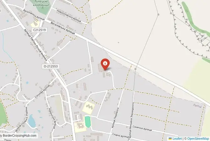
Approximate Border Location
Wait Times
30–180 min delays
Just crossed? Tap to report:
Operating Hours
Open 24 hours
Crossing Types
People, cars, freight
Border Type
Land crossing via road
Peak Times
7–10 AM, weekends
Daily Crossings
2,000–3,000 daily
Safety Information
Security screening
Languages Spoken
Ukrainian/Russian
Accessibility Features
Ramps, elevators
About Strilecha & Zhuravlyovka
Monthly Update (June 2026):
During recent weeks in June 2026, the Strilecha & Zhuravlyovka Border Crossing has stayed quiet, but the overall picture remains unpredictable. Crossings are infrequent, and any processing tends to take time because procedures can shift. Weather and short-term events are usually what affect waiting times.
A Closed Local Crossing on the Frontline
Important Note for Travelers: Due to the ongoing war, this border crossing is closed and the entire region is a high-risk security zone and an active frontline. It is not operational as of early 2026. This guide is provided for historical and informational purposes only. The border crossing connecting the Ukrainian village of Strilecha with Zhuravlyovka in Russia was a small, local checkpoint situated in the immediate northern suburbs of the city of Kharkiv. This was not a route for international transit but an essential link for the communities in the densely populated agricultural and dacha (summer house) region that straddles the border. To cross here was to experience the border at its most local and integrated level, a simple road connecting villages that were, in practice, part of the same greater metropolitan area. Its closure and the subsequent transformation of the area into a battlefield represent the brutal severing of these deep, local ties.
Operational Details
This checkpoint connected Ukraine’s Kharkiv Oblast with Russia’s Belgorod Oblast. It was a smaller crossing, likely with limited hours, intended for passenger cars and local traffic. Its purpose was to facilitate the everyday life of a region where the international border cut through a continuous landscape of settlement. It allowed people to access their dachas, visit relatives, or travel between villages without making the longer journey to the main highway crossing at Hoptivka-Nekhoteyevka. It was a crossing born of local necessity.
A History of an Integrated Region
The history of this region is one of almost complete integration with the city of Kharkiv. The villages on both sides of the border were effectively suburbs or exurbs of the great city. During the Soviet era, the administrative line between the Ukrainian SSR and the Russian SFSR was of little consequence. After 1991, the new international border created a major complication for the local residents. The Strilecha-Zhuravlyovka crossing was a pragmatic solution that allowed a semblance of normal life to continue. It was a place where the border was a formality to be navigated in the course of a daily routine.
Signal can be a coin toss at borders, and the last thing you want is to be stuck at the gate hunting for info. We’ve pulled all our research for this region into one simple eBook that works 100% offline. It keeps everything you need in one spot so you can stay focused on the trip. Grab the guide here.
Former Border Procedure
The border crossing procedure, when it was operational, was a standard two-part process. Travelers would first complete exit formalities at the Ukrainian checkpoint at Strilecha. They would then proceed to the Russian entry checkpoint at Zhuravlyovka for a full inspection by the Russian Border Guard Service and Federal Customs Service. A valid passport and, if required, a Russian visa were necessary. As a smaller, local crossing, the process was generally less formal and faster than at the main highways, serving a community that was familiar to the guards on both sides.
The Surrounding Region
The surrounding area is a densely populated, agricultural and recreational region on the immediate northern outskirts of Kharkiv. On the Ukrainian side, Strilecha is a significant village that has been on the frontline of the war since 2022. On the Russian side, the crossing leads into the Belgorod Oblast. The entire region is characterized by its close proximity to the two major cities of Kharkiv and Belgorod. It is a landscape that, until recently, was defined by its peaceful, suburban character.
Transformation into a Conflict Zone
The closure of this crossing was an immediate consequence of the full-scale Russian invasion of Ukraine in February 2022. This area was on the direct line of advance for Russian forces attacking Kharkiv from the north. The village of Strilecha was occupied. After the liberation of the area in the September 2022 Ukrainian counteroffensive, the border became an intense frontline. The village and the surrounding area have been subjected to constant and devastating shelling, and in May 2024, it became one of the focal points of a new Russian offensive into the Kharkiv region, with the situation unchanged as of early 2026.
Final Considerations
The Strilecha–Zhuravlyovka border crossing was once a symbol of the deep, everyday integration of the Kharkiv-Belgorod cross-border metropolitan region. It was a place of routine, local travel. Today, it is a name synonymous with intense combat and destruction. It is a stark example of how the war has turned the most peaceful and integrated of places into the most dangerous. The quiet country road that once connected suburban villages is now a fortified and deadly no-man’s-land, a tragic symbol of a community and a relationship that has been utterly shattered by the invasion.
No reviews yet.