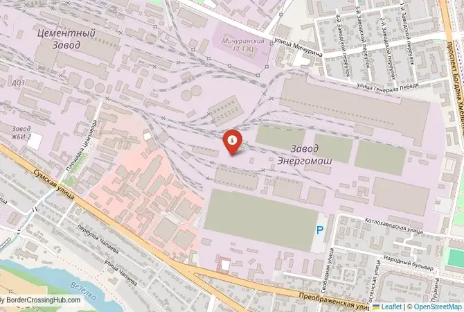
Approximate Border Location
Wait Times
30–180 min peak delays
Just crossed? Tap to report:
Operating Hours
Open 24 hours
Crossing Types
People, cars, freight
Border Type
Land crossing via road
Peak Times
7–10 AM, weekends
Daily Crossings
3,000–5,000 daily
Safety Information
Controlled crossing zone
Languages Spoken
Ukrainian/Russian
Accessibility Features
Ramps, elevators
About Dolbino & Kozacha Lopan
Monthly Update (June 2026):
During June 2026, the Dolbino & Kozacha Lopan Border Crossing has stayed quiet and unpredictable. There is little consistent movement, and inspections can stretch waits whenever crossings are possible. Conditions on the ground and seasonal weather are what usually shape the pace.
A Closed Local Crossing on the Frontline
Important Note for Travelers: Due to the ongoing war, this border crossing is closed and the entire region is a high-risk security zone and an active frontline. It is not operational as of early 2026. This guide is provided for historical and informational purposes only. The border crossing connecting the Ukrainian town of Kozacha Lopan with the area near Dolbino in Russia was a key local checkpoint for both road and rail traffic. Situated just north of the city of Kharkiv, this was not the main international superhighway, but it was an incredibly important local artery. It served the dense network of towns and villages in the Kharkiv and Belgorod oblasts, which have been historically intertwined for centuries. To cross here was to experience the border at a community level, a routine journey for commuters, shoppers, and families. Today, this once-bustling local crossing is a silent and heavily fortified part of an active warzone, a place that vividly illustrates the human cost of the conflict.
Operational Details
This checkpoint connected Ukraine’s Kharkiv Oblast with Russia’s Belgorod Oblast. It was a significant local crossing, with facilities for both passenger cars and a parallel railway line. The rail line was particularly important, as it was the main suburban train route connecting Kharkiv with Belgorod, a service used by thousands of commuters daily. The road crossing served the many smaller roads that crisscross this densely populated border region. Its closure has had a devastating impact on the local communities who relied on it for their daily lives, severing connections that were as routine as traveling to a neighboring suburb.
A History of an Integrated Region
The history of this region is one of almost complete integration. Kharkiv and Belgorod have been linked economically, culturally, and demographically for centuries. The area is part of the historic Sloboda Ukraine region, a borderland colonized and developed jointly by Ukrainians and Russians. During the Soviet era, the two cities were part of a single, integrated economic zone, with infrastructure and supply chains designed without regard for the administrative line between the two republics. After 1991, the new international border seemed like a formality. The suburban train from Kharkiv to Belgorod was as normal as a train from one city district to another. The Kozacha Lopan-Dolbino crossing was the point where this routine, daily integration was formalized, a checkpoint that was a constant, familiar part of the local landscape.
Signal can be a coin toss at borders, and the last thing you want is to be stuck at the gate hunting for info. We’ve pulled all our research for this region into one simple eBook that works 100% offline. It keeps everything you need in one spot so you can stay focused on the trip. Grab the guide here.
Former Border Procedure
The border crossing procedure, when it was operational, was a standard two-part process, but one that was highly practiced due to the volume of local traffic. For the road crossing, travelers would complete checks at the Ukrainian and Russian checkpoints. For the railway crossing, border guards from both countries would board the suburban train at the border stations (Kozacha Lopan and Dolbino) and check documents as the train moved, a process designed to be as quick as possible for the daily commuters. Even so, it was a formal international border with full controls, a reminder of the new political reality that had emerged after 1991, but one that was managed to allow life to continue as normally as possible.
The Surrounding Region
The surrounding area is a densely populated, industrialized, and agricultural region. On the Ukrainian side, Kozacha Lopan is a significant town that has been on the frontline of the war since 2022. It is on the immediate outskirts of the Kharkiv metropolitan area, Ukraine’s second city and a major center for science, education, and industry. On the Russian side, the crossing leads directly to the major city of Belgorod. The close proximity of the two cities meant that the border area was essentially a continuous suburban and rural landscape, with deep and complex cross-border ties, where a person might live in one country and work or study in the other.
Closure and Occupation Due to War
The closure of the Kozacha Lopan-Dolbino crossing was one of the first events of the full-scale invasion on February 24, 2022. This route was a primary axis of advance for the Russian army’s attack on Kharkiv. The town of Kozacha Lopan was occupied by Russian forces on the first day of the war. It remained under a brutal occupation for over six months until it was liberated during the successful Ukrainian counteroffensive in September 2022. The area has been devastated by the fighting and remains under constant threat of shelling and cross-border attacks, a place scarred by war crimes and heroic resistance, with the situation unchanged as of early 2026.
Final Considerations
The Kozacha Lopan–Dolbino border crossing was once the ultimate symbol of the deep, everyday integration between the Kharkiv and Belgorod regions. The daily commuter train was a testament to a time when the border was just a line, not a barrier. Today, it is a symbol of a brutal occupation and a heroic liberation. The silent, battle-scarred checkpoint and the severed railway line are powerful reminders of the human cost of the war. It is a place where the routine of daily life was shattered overnight, and a simple commute became an impassable and deadly frontline, a stark lesson in how quickly neighborly connection can be replaced by fortified hostility.
No reviews yet.