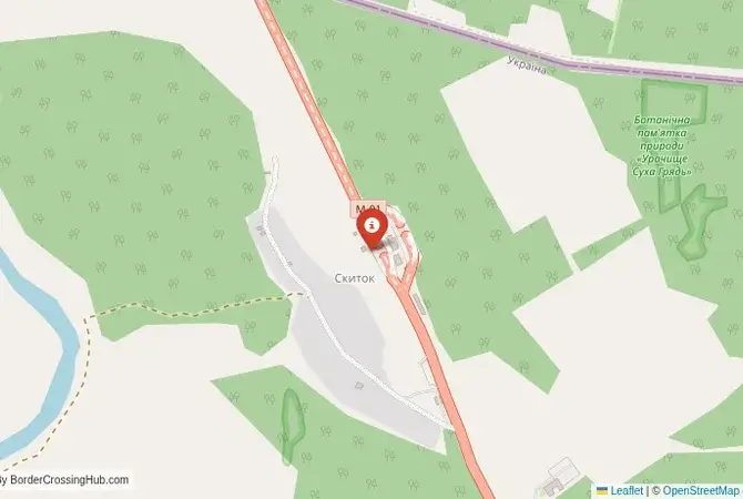
Approximate Border Location
Wait Times
15-60 min for pedestrians/vehicles
Operating Hours
Open 6:00 AM – 8:00 PM
Crossing Types
Pedestrians, vehicles
Border Type
Land crossing via road
Peak Times
Mornings (7-10 AM)
Daily Crossings
~1000 travelers/vehicles
Currency Exchange
Limited near Novaja Huta (BYN, UAH)
Safety Information
Remote, rural hazards
Languages Spoken
Belarusian/Ukrainian
Accessibility Features
Ramps, limited assistance
About Novaja Huta & Novi Yarylovychi
The Main Minsk-Kyiv Highway Crossing
Important Note for Travelers: Due to the ongoing war in Ukraine and the volatile political situation with Belarus, this border crossing is closed and the entire region is a high-risk security zone. It is not operational. This guide is provided for historical and informational purposes only.
The border crossing connecting Novaja Huta in Belarus with Novi Yarylovychi in Ukraine was the primary and most modern highway checkpoint between the two nations. This was the main artery, the E95 highway, the most direct route between the two capital cities, Minsk and Kyiv. It was a massive, 24/7 international facility, built to handle a huge volume of traffic. This was the undisputed workhorse of the Belarus-Ukraine border, a critical corridor for trade, tourism, and transit. Its character was defined by its scale, its constant motion, and its strategic importance as the premier link between the two countries. Its closure has severed the most important road connection between the two neighbors.
Operational Details
This checkpoint connected the Gomel Region of Belarus with the Chernihiv Oblast of Ukraine. It was a full-service international crossing, open to all passenger cars and commercial freight. The facility was the newest and most modern on the border, designed with multiple lanes, large canopies, and advanced inspection equipment to process a high volume of traffic as efficiently as possible. It was the preferred route for most long-distance travelers and for the majority of the freight moving between the two countries.
Before Crossing
Crossing borders gets messy sometimes, think political flare-ups or gates shutting fast. Good travel insurance is a must for handling doctor visits, trip disruptions, or security scares. Don’t get caught unprepared. To find a policy that’s got your back, check out reliable plans today for peace of mind.
A History of a Modern Corridor
The history of this route as a modern highway is relatively recent. During the Soviet era, the road was an important internal link. After the independence of Belarus and Ukraine in 1991, it became the most important international corridor between them. In the 2010s, both countries invested heavily in upgrading the highway and the border facilities, recognizing its critical economic importance. The new, modern checkpoint complex was a symbol of the strong trade and travel ties that existed between the two nations prior to 2014. It was designed for a future of even greater integration and cooperation.
Former Border Procedure
The border crossing procedure, when it was operational, was a large-scale, two-part process. Travelers would first complete exit formalities at the modern Belarusian checkpoint at Novaja Huta. This involved checks by border guards and customs officials in a multi-lane facility. They would then proceed to the equally large and modern Ukrainian entry checkpoint at Novi Yarylovychi for a full inspection by the Ukrainian State Border Guard Service. A valid passport and vehicle documents, including international insurance (Green Card), were required. Despite the modern infrastructure, the sheer volume of traffic meant that queues, especially for freight trucks, were a constant feature. The wait could often be many hours.
The Surrounding Region
The surrounding area is a rural landscape of forests and fields, part of the Polesie region. On the Belarusian side, the crossing is south of the major city of Gomel, the administrative center of the region. On the Ukrainian side, the crossing is the gateway to the Chernihiv Oblast. The road leads south towards the historic city of Chernihiv, one of the oldest and most historically significant cities in Ukraine, known for its magnificent ancient cathedrals and monasteries. From Chernihiv, the highway continues on to the capital, Kyiv. The region is largely agricultural, with the road passing through numerous small villages.
Closure Due to War
The closure of the Novaja Huta-Novi Yarylovychi crossing was an immediate and direct consequence of the full-scale Russian invasion of Ukraine in February 2022. This highway was a primary axis of advance for the Russian military convoy moving from Belarus towards Kyiv. The area around the border and the highway to Chernihiv saw some of the most intense fighting in the initial phase of the war. The checkpoint itself was captured by Russian forces. After the retreat of Russian forces from the Kyiv and Chernihiv regions, the border was sealed by Ukraine and has become a heavily fortified and militarized zone.
Final Considerations
The Novaja Huta–Novi Yarylovychi border crossing was once the flagship checkpoint between Belarus and Ukraine, a symbol of modern infrastructure and strong economic ties. It was the busiest and most important road connecting two capital cities. Today, the modern, multi-million dollar facility stands silent and damaged, a casualty of the war it helped to facilitate. It has been transformed from a symbol of connection into a symbol of aggression and division. The empty highway is a stark reminder of the broken relationship between the two nations and the devastating cost of the conflict.
No reviews yet.
