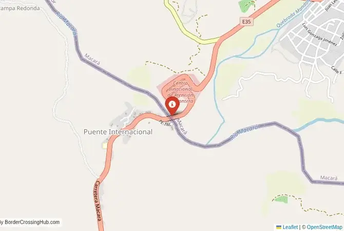
Approximate Border Location
Wait Times
30-90 min for pedestrians/vehicles
Just crossed? Tap to report:
Operating Hours
Open 8:00 AM – 6:00 PM
Crossing Types
Pedestrians, vehicles
Border Type
Land crossing via bridge
Peak Times
Mornings (7-10 AM), weekends
Daily Crossings
~3000 travelers/vehicles
Safety Information
Generally safe, beware touts
Languages Spoken
Spanish
Accessibility Features
Ramps, assistance
About Macará & La Tina
Monthly Update (June 2026):
As of 06/2026, La Tina & Macará Border Crossing is mostly stable, with traffic usually moving at a steady pace. Vehicle checks can slow things down when several cars arrive together, while quieter periods pass quickly. Weather and seasonal travel can still affect waiting times.
The Main Inland Crossing
The border crossing connecting the Ecuadorian town of Macará with La Tina in Peru is the most important inland checkpoint between the two nations. This is a major international crossing, a bridge over the Macará River that serves as a vital artery for trade and travel, offering a crucial alternative to the busier and more chaotic coastal crossing at Huaquillas-Aguas Verdes. To cross here is to travel through the dry, rolling foothills of the Andes, a landscape of scrub forest, agriculture, and a history of a once-tense but now peaceful frontier. It is a workhorse of a border, a functional and generally efficient passage that is the preferred route for many overland travelers and commercial truckers.
Operational Details
This checkpoint connects Ecuador’s Loja Province with the Piura Department of Peru. It is a major international crossing, open 24/7 to all passenger cars, buses, and commercial freight. The facility is modern and well-organized, with the immigration and customs offices of both countries located in close proximity on either side of the international bridge. The crossing is a key part of the international highway that connects the southern Ecuadorian highlands with the northern coast of Peru. While it is a major route, the traffic is generally more manageable than at the coastal crossing, making it a less stressful experience for many.
A History of a Contested Frontier
The history of this region is the history of a long and often tense border dispute between Ecuador and Peru, which was only finally resolved by a peace treaty in 1998. For decades, this was a militarized and underdeveloped frontier. The peace agreement ushered in a new era of cooperation and integration. The modernization of the Macará-La Tina crossing and the paving of the highways on both sides was a direct result of this new, peaceful relationship. The crossing is a powerful symbol of this successful conflict resolution, a bridge that has replaced suspicion with commerce and cooperation.
Signal can be a coin toss at borders, and the last thing you want is to be stuck at the gate hunting for info. We’ve pulled all our research for this region into one simple eBook that works 100% offline. It keeps everything you need in one spot so you can stay focused on the trip. Grab the guide here.
Border Crossing Procedure
The border crossing procedure is a standard two-part process. You must first get your exit stamp from one country’s immigration office. You then walk or drive across the bridge to the other country’s checkpoint for their entry inspection. You will need a valid passport. Many nationalities can enter both countries visa-free for short stays, but it is essential to check the specific requirements in advance. Vehicle registration and international insurance (SOAT for Peru) are also necessary. The process is generally straightforward and the officials are professional, but it can be slow if several international buses arrive at once; occasional additional documentation like criminal record certificates may apply for land entry to Ecuador due to periodic security measures.
The Surrounding Region: Ecuador Side
On the Ecuadorian side, the crossing is in the town of Macará. The road from the border climbs into the beautiful southern Ecuadorian Andes. The nearby city of Loja is a major cultural and academic center, known as the “Music and Culture Capital of Ecuador.” The region is a gateway to the magnificent Podocarpus National Park, one of the most biodiverse places on Earth, a paradise for birdwatchers and hikers. The charming town of Vilcabamba, in the “Valley of Longevity,” is also in this region, a popular destination for expatriates and wellness tourists.
The Surrounding Region: Peru Side
On the Peruvian side, the crossing is the gateway to the northern Peruvian coast and the Piura region. The road descends from the foothills to the coastal plains. The nearby city of Sullana is a major agricultural hub. The main destination for most travelers is the city of Piura, the first city founded by the Spanish in Peru. The region is known for its beautiful beaches, such as Máncora and Vichayito, which are famous for their surfing and relaxed atmosphere. The region is also known for its unique cuisine, particularly its excellent seafood ceviche.
Practical Travel Information
Practical planning for this route is straightforward. The main road is well-maintained. The official currencies are the US Dollar (USD) in Ecuador and the Peruvian Sol (PEN) in Peru. Currency exchange facilities are available at the border. Ensure your vehicle has the required international insurance. The climate in the border region is hot and dry. Services like petrol stations are available in the towns on both sides of the border. This crossing is the most popular choice for overlanders driving the Pan-American Highway.
Final Considerations
The Macará–La Tina border crossing is a vital economic and tourist artery. It is a busy, functional checkpoint that serves as a gateway to the beautiful southern highlands of Ecuador and the sunny northern coast of Peru. It is a journey through a landscape of dry forests and a region with a history of conflict that has been replaced by cooperation. For the modern traveler, it is the most efficient and pleasant route for exploring the diverse natural and cultural treasures of this fascinating corner of South America.
No reviews yet.