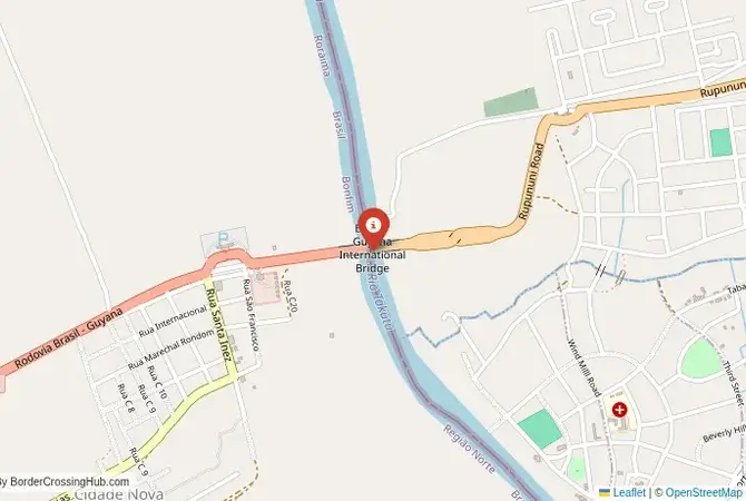
Approximate Border Location
Wait Times
30–90 min peaks
Just crossed? Tap to report:
Operating Hours
08:00 AM–06:00 PM
Crossing Types
Pedestrians; vehicles
Border Type
Land crossing via bridge
Peak Times
07–10 AM; weekends
Daily Crossings
1k–2k/day
Safety Information
Low crime; scam attempts
Languages Spoken
Portuguese, English
Accessibility Features
Ramps; assistance
About Bonfim & Lethem
Monthly Update (June 2026):
In 06/2026, Bonfim & Lethem Border Crossing is mostly stable, with waits usually tied to the number of cars and trucks arriving at the same time. The Guyana side can be a little slower when inspections build up, especially during busy periods. Holidays and seasonal road conditions may affect the crossing speed.
A Crossing in the Rupununi Savannahs
The border crossing connecting the Brazilian town of Bonfim with Lethem in Guyana is the only official land border between the two nations. This is a journey into the heart of the Guiana Shield, a vast and ancient geological formation. To cross here is to travel over the Takutu River Bridge, a passage from the Portuguese-speaking world of Brazil to the English-speaking, Caribbean-influenced world of Guyana. It is a journey through the stunning and remote landscape of the Rupununi savannahs, a land of vast grasslands, termite mounds, and a rich indigenous culture. It is a crossing that is a true frontier, a gateway to one of the most wild and least-visited parts of South America.
Operational Details
This checkpoint connects Brazil’s Roraima state with the Upper Takutu-Upper Essequibo region of Guyana. It is a major international crossing, but the traffic is relatively light due to the remoteness of the region. The Takutu River Bridge, opened in 2009, was a major infrastructure project that created the first permanent, all-weather link between the two countries. The crossing operates with limited hours, and it is essential to check the current schedule before travel. A unique feature of this crossing is the change in driving side: Brazil drives on the right, while Guyana drives on the left. There is a special crossover lane on the bridge to manage this change.
A History of a New Connection
The history of this region is the history of the indigenous Macushi and Wapishana peoples. The modern border was demarcated in the early 20th century. For decades, the only way to cross the Takutu River was by a small, unreliable ferry. The region was almost completely isolated. The construction of the bridge was a major strategic project for both countries, designed to boost trade and to integrate Guyana more closely with its South American neighbors. It has opened up a new overland route for goods and for adventurous travelers seeking to explore the interior of Guyana.
Signal can be a coin toss at borders, and the last thing you want is to be stuck at the gate hunting for info. We’ve pulled all our research for this region into one simple eBook that works 100% offline. It keeps everything you need in one spot so you can stay focused on the trip. Grab the guide here.
Border Crossing Procedure
The border crossing procedure is a standard two-part process. You will first complete exit formalities at one country’s checkpoint and then proceed across the bridge to the other country’s checkpoint for entry inspection. The immigration and customs offices are located in modern facilities at either end of the bridge. You will need a valid passport. Visa requirements for Guyana vary by nationality, and it is essential to check them in advance. A yellow fever vaccination certificate is often required. Vehicle registration and international insurance are also necessary.
The Surrounding Region: Brazil Side
On the Brazilian side, the crossing is in the town of Bonfim. The state of Roraima is Brazil’s northernmost state, a region of savannahs and rainforest. The capital city, Boa Vista, is about an hour and a half’s drive away. The region is home to a large number of indigenous communities, and the Raposa Serra do Sol indigenous territory is located in this state. The Brazilian side of the border is also home to Monte Roraima, the famous triple-point tepui, though it is not accessible from this route.
The Surrounding Region: Guyana Side
On the Guyanese side, the crossing is in the town of Lethem, the administrative center of the Rupununi region. Lethem is a dusty, bustling frontier town that serves as the hub for the vast cattle ranches and indigenous communities of the savannahs. It is the gateway to the magnificent Kaieteur Falls, one of the most powerful waterfalls in the world, though this requires a flight from Lethem. The Iwokrama International Centre for Rainforest Conservation and Development and the Kanuku Mountains are also in this region. The journey from Lethem to the capital, Georgetown, is a long and arduous overland adventure on a largely unpaved road.
Practical Travel Information
Practical planning is absolutely essential for this route. The road on the Guyanese side is very challenging and often requires a 4×4 vehicle, especially in the rainy season. The official currencies are the Brazilian Real (BRL) in Brazil and the Guyanese Dollar (GYD) in Guyana. Be prepared for the change in driving side. Services are limited, especially in the interior of Guyana. Ensure you have all necessary vehicle documents and insurance. Be aware of the health risks of travel in the region.
Final Considerations
The Bonfim–Lethem border crossing is a journey for the true adventurer. It is a modern bridge in the middle of a wild and beautiful landscape. It is a passage that connects the two great cultures of South America, the Latin and the Caribbean. For the adventurous and well-prepared traveler, it offers an unforgettable overland journey into the heart of one of the world’s last great wildernesses. It is a crossing that is a gateway to the pristine rainforests and savannahs of Guyana, a true frontier experience.
No reviews yet.