Monthly Update (September 2026):
Col Agnel & Colle Agnello remains a high-altitude scenic crossing with no significant September closure identified. Unlike the Mont Blanc and Fréjus tunnels, this route is primarily recreational and carries relatively little through traffic. September weather is becoming the main variable as temperatures fall at altitude. Travelers should check the latest mountain-road status before setting out, particularly after snow or heavy rainfall.
About this crossing
Location and Basic Connections
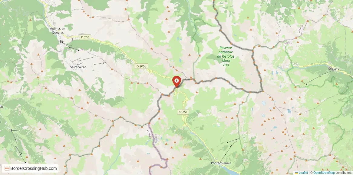
You find this high pass deep in the Queyras and Varaita valleys, roughly 25 km south of Château-Ville-Vieille on the French side and 20 km from Pontechianale on the Italian side. The D902 road (France) climbs from the Guil valley through narrow gorges and alpine meadows to the summit, while the SP251 (Italy) ascends from the Varaita valley past the hamlet of Castello. No major highways serve the pass; access depends on winding secondary roads. Regional buses from Briançon or Guillestre reach the French valley base, then private vehicles or taxis tackle the final steep sections. On the Italian side, connections come from Saluzzo or Cuneo. The route draws cyclists chasing legendary climbs, hikers on the GR58 and GTA trails, and drivers seeking quiet alpine transits rather than high-volume freight.
Alternative Names
This point is known as Col Agnel (French), Colle Agnello (Italian), Col d'Agnel, or the Château-Queyras-Pontechianale frontier.
Nearby Border Crossings


Historical Background
The pass follows ancient mule paths used by shepherds and traders across the Cottian Alps. It gained strategic importance during the 18th and 19th centuries amid Franco-Sardinian border disputes. The road was paved in the 1970s as a binational project to boost tourism and local ties. The summit features a monument to the 2008 Giro d'Italia stage won by Emanuele Sella and a small chapel dedicated to Saint Mary. The area ties into the Queyras and Varaita valleys' pastoral heritage, with transhumance routes crossing the col for centuries. Modern upgrades improved safety, but the pass retains its raw, high-altitude character.
Geopolitical Significance
As a Schengen internal border, Col Agnel has no permanent passport controls or booths; France and Italy allow free movement for most travelers. France's temporary internal Schengen checks (extended to April 30, 2026, for security reasons including terrorism threats, antisemitic incidents, migration smuggling, and public order) can lead to random ID or vehicle inspections across borders including Italy, though remote high passes like this see them very rarely compared to motorways. The crossing supports tourism, winter sports access, and occasional local trade in this sparsely populated alpine zone. In early 2026, the pass remains closed to vehicles for the winter season (typical closure from late October to late May or early June), with the exact reopening depending on snowmelt and road clearance. No unusual long-term restrictions reported beyond seasonal closure; always confirm real-time status via departmental road services or local tourism sites.
Practical Crossing Procedures
When open, you drive or cycle straight over the summit without stopping under Schengen rules. The border is marked by a stone pillar, signs, and a small parking area at the top. Random patrols by French or Italian police may request ID, check documents, or inspect goods, but these are infrequent here. Most nationalities cross freely (90 days visa-free short stay in Schengen). Carry your passport or national ID for any verification. Vehicles need registration and insurance; chains or winter tires mandatory in season (though irrelevant during closure). Customs limits apply for alcohol, tobacco, or other items; declare excesses. Pedestrians and cyclists cross easily, though the road is steep and exposed. Current winter closure means no vehicle transit; hiking trails allow foot access around the summit when snow permits, but avalanche risks apply.
Typical Wait Times and Operating Hours
When open, the pass operates 24/7 with no formal hours or queues. Random checks, if they occur, last minutes. The seasonal closure (typically late October to late May/early June) eliminates vehicle access entirely. Snowmelt and road clearance determine reopening, often announced in spring by Hautes-Alpes or Cuneo authorities. No structured delays apply beyond weather and seasonal factors.
Transportation Options
Private cars or motorcycles manage the steep climb best when open. Regional buses reach Château-Ville-Vieille (France) or Sampeyre/Pontechianale (Italy), then taxis or rideshares continue. No direct public buses cross routinely. Cycling is legendary for the challenging gradients (average 7-8%, with steeper pitches up to 11%). The route suits overlanders, cyclists, or those linking Queyras and Varaita valleys.
Road Conditions and Scenery
The French D902 features long, steady climbs through gorges, forests, and open pastures. The Italian SP251 side feels more abrupt with tighter switchbacks. Roads stay narrow with exposure in places. The summit delivers 360-degree views of Mont Viso (3,841 m), Monte Granero, and surrounding glaciers. Scenery shifts from deep valleys to stark alpine meadows, with marmots, ibex, and wildflowers in summer. Winter snow closes the road reliably; summer offers clear but exposed driving. Chains or winter tires mandatory when snowy; avalanche risks possible.
Scams & Warnings
This remote high pass sees almost no scams or touts. Weather hazards dominate: avalanche closures, ice, or sudden storms strand drivers; carry supplies and check status. Random checks may occur; cooperate fully. The area has low crime against visitors but high mountain driving risks (exposure, altitude effects, narrow lanes). Current seasonal closure (ongoing in February 2026) makes vehicle transit impossible until spring reopening; avoid planning around it without confirmation. Hiking trails exist but require proper gear and avalanche awareness.
Nearby Attractions
Château-Ville-Vieille (France) offers Queyras village charm, the Château-Queyras fortress, and access to the Queyras Regional Nature Park for hikes and skiing. La Thuile (Italy) provides skiing and trails into the Aosta Valley. The pass links to Mont Viso massif hikes, the GR58 Tour du Queyras, and the Via Alpina. The summit chapel and Roman ruins add historical interest.
Seasonal Variations and Delays
Summer (June-October) normally provides open roads and tourism peaks. Winter closes the pass due to heavy snow (typical from late October). The extended closure into spring 2026 follows standard patterns; weather overrides all. Recent years saw reliable summer openings.
Cultural and Economic Role
The pass sustains cross-border tourism and local ties between Queyras and Varaita valleys. It blends Occitan and Piedmontese alpine culture in food, festivals, and mountain heritage.
Final Planning Notes
The pass is currently closed (February 2026); plan alternatives like Montgenèvre or Fréjus tunnel. Carry ID, chains in season, and monitor reopening via official sites (hautes-alpes.fr or regione.piemonte.it). This suits adventurers ready for high-mountain conditions when accessible.
Crossing This High Cottian Pass
Col Agnel Colle Agnello stands as one of Europe's loftiest paved border crossings, where stark alpine summits divide France and Italy with breathtaking views and minimal formalities when open. With the current seasonal closure in place, wait for spring reopening, check conditions carefully, and prepare for steep, exposed roads to experience this remote frontier link in the heart of the Cottian Alps.
View all border crossings between France and ItalyPractical information
Currency
EUR only; ATMs in Queyras/Sampeyre
Safety information
Very high pass; weather closes quickly
Connectivity
Wi-Fi points; 4G
Have you crossed here?
Help other travelers by sharing your experience, wait times, and any updates.